

From the YouTube description:
(0:05) Prior to the current alignment separating north and southbound traffic via the Blanshard extension (1978), Highway 17 started on Douglas Street near Carey Road. Before the highway was officially numbered in the 1960s, it was called East Saanich Road along a large portion of the route.
(0:10 – 0:16) In 1966, McKenzie Avenue was a small rural street with no connection to Highway 1. Highway traffic travelled alongside the Swan Lake/Christmas Hill area, then across McKenzie Avenue, towards Royal Oak. If you look closely, you can see school children along either side of the highway, possibly heading to Pacific Christian School nearby.
(0:32) Quadra Street joins up with the highway on the right. The Quadra Street overpass, connecting with the Royal Oak shopping area won’t be built until the 1970s.
(0:36) Junction of Highway 17 and 17A (also known as West Saanich Road). This route accessed the famous Butchart Gardens, as well as the ferry across the Saanich Inlet to Mill Bay. 17A was a formal alternate route through the peninsula. Highway 17A was designated in 1962, but lost its designation in 2000.
(0:45-0:53) Before the divided highway of today, Highway 17 ran directly in front of Beaver Lake Park, along what is now called Elk Lake Drive.
(1:00) Haliburton Road on your right
(1:16) Sayward Road Intersection
(1:40) Keating Cross Road exit
(1:42) East Saanich Road continues off to the left
(1:48) Island View Road intersection
(2:07) Mt. Newton Cross Road intersection
(2:40) McTavish Road intersection
(2:58) Beacon Avenue Intersection and Sidney
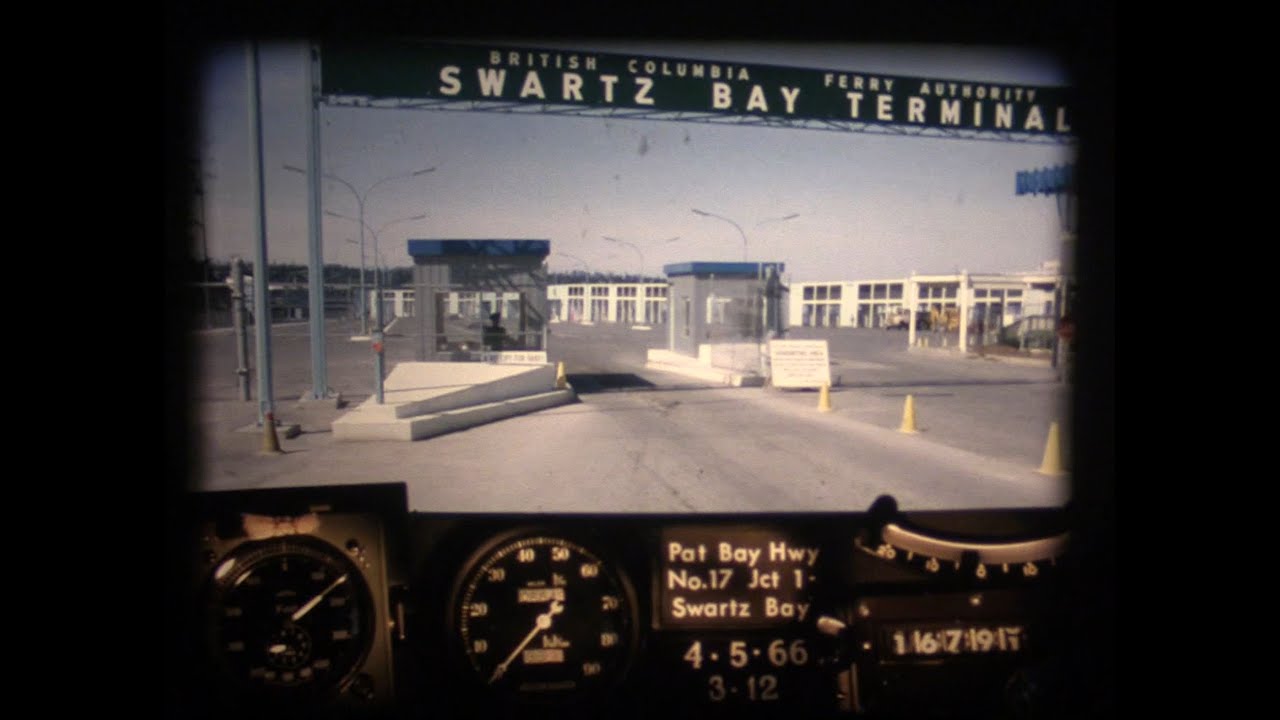
(3:07-3:37) Road widening work to and from Swartz Bay Ferry Terminal
(3:27) Wain Road intersection
You must log in or register to comment.